
The Exile
BURGOS - SORIA - GUADALAJARA


: desde aquí partió Rodrigo hacia el destierro, según cuenta el Cantar, \"con lágrimas en los ojos\" / ALC.")


, donde tradicionalmente se ubica el pasaje del Cantar de la Afrenta de Corpes / ALC.")


 por la Federación de Montaña. El número de GR del Camino del Cid es el 160 / Diputación de Guadalajara.")

, desde el Camino del Cid / ALC.")
The Exile by mountain bike. Follow the steps of El Cid around the old Kingdom of Castile.
• Route: From Vivar to Atienza.
• Provinces: Burgos, Soria, Guadalajara
• Kilometres: Approx. 297 km.
• Days recommended: 6 days (5 nights) including the prologue stage of Vivar del Cid - Burgos (12 km), during which you will be able to visit the capital city of the province of Burgos.
• Difficulty: Low-medium
Information you can download on this page
- The MTB route guide: contains technical and practical information, a description of the route, maps, gradients, difficulty, bicycle repair shops, stamping points and relevant milestones, etc.
- MTB track in GPX, KMZ and TRK format. To always be on the correct track you can download Mapas de España (Maps of Spain) app (only android version available) from the Spanish National Geographic Institute, from where you can access to all of our routes and navigate on accurate maps as well as to obtain additional features for free.
- List of accommodation.
- List of points for obtaining and stamping the Letter of safe conduct.
- List of tourist information offices.
- Tourist brochure (this can be obtained at any of the tourist information offices on the route).Only available in Spanish.
Remember that you can obtain more information about each route at the tourist information offices on the Way of El Cid, including brochures and the Letter of safe conduct.
Download our travel app free of charge
We recommend that you download our mobile travel app, available for iOs and Android. With this app you can find all our routes, you’ll never get lost because you’ll always know exactly where you are, and you can view information about 4,500 georeferenced places (sites connected with El Cid, things to see, accommodation, places where you can have your letter of safe conduct stamped, etc.)
The app is free, is updated daily and does not require registration. It also works in places without a signal and therefore, when it is being installed and used for the first time, it may take some time to become active, depending on your internet connection. Be patient because it’s worth it!
For more information about the Camino del Cid travel app, click here.  Download our travel app free of charge
Plot: follow the steps of El Cid
In general, this section follows the early days of El Cid's exile as told in the Poem of The Cid, although it also includes other passages from the poem, such as the Afrenta de Corpes. El Cid, exiled, leaves Vivar with a handful of knights ordered by the king to leave Castile in nine days, a term El Cid uses to leave his daughters and his wife in the monastery of San Pedro de Cardeña, stock up on ammunition and stores and increase his small group of loyal followers by enlisting new knights and soldiers.
Although El Cid leaves Castile via the Pela Mountain Range, today on the border between Soria and Guadalajara (a mountain range that stood as the natural border in 1081 between the Christian kingdom of Castile and the Islamic kingdom of Toledo), our route ends at the next important town in Al Andalus: the historical town of Atienza, an Arabic military site on the border and of great importance in the 10th and 11th centuries. This journey to exile is combined with the famous episode of the Afrenta de Corpes narrated in the Poem, where El Cid's daughters are abused and abandoned by their husbands. Traditionally, academics have placed this legendary event in Castillejo de Robledo.
The journey: what you will find
On this route you will see a large part of the essence of Castile, one of the most important kingdoms of Spain in the Middle Ages. The countryside alternates with dry cropland in the valleys of the Rivers Arlanza and Duero with juniper, oak and pine forests and flat land and moors. The route crosses six natural areas protected by the Natura 2000 Networking Programme, including the juniper forest in the valley of El Arlanza and La Yecla (a limestone cliff as you leave Silos and next to the road, well worth a visit) and the area around the River Duero in Soria, which is of great environmental importance, but which was also geographically and politically important in the Middle Ages since it was the natural border between Castile and Al Andalus. This importance can be seen in the many lookout posts and castles that mark out this unique area between Langa de Duero and Berlanga de Duero, whose emblem is the huge caliphal fortress of Gormaz, once governed by El Cid.
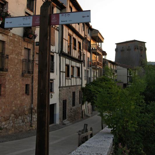
You will pass by two of the large foundational monasteries of Castile: that of San Pedro de Cardeña and that of Silos, and very close to that of Arlanza (8 km from Covarrubias), and you will visit mythical places that form part of the history of El Cid, including Vivar del Cid, San Pedro de Cardeña, Castillejo de Robledo and San Esteban de Gormaz, among others. Of course, the route also includes Burgos, the city of El Cid par excellence, with good infrastructures for cycling tourists and excellent monuments with its Gothic cathedral at the top of the list, declared a World Heritage Site. On the route, you will also come across many examples of Romanesque architecture in the fascinating cloister of Santo Domingo de Silos, the paintings in the shrine of San Miguel in Gormaz, the churches of San Esteban de Gormaz and in many other villages that have examples of the so-called rural Romanesque style, which is very humble but highly suggestive and evocative. This section is also predominated by small, quiet villages, some of which have maintained their medieval 'aroma' and are of recognised interest, such as Covarrubias, Santo Domingo de Silos, Langa de Duero, San Esteban de Gormaz, El Burgo de Osma, Berlanga de Duero and, of course, at the end of this route, in Guadalajara, the impregnable Atienza, all of which have been declared Historical and/or Artistic Sites.
El Cid and culinary delights
As far as gastronomy is concerned, on this route you must remember to try the famous black pudding of Burgos, a reference in traditional Burgos cuisine, which is based on heavy stews, such as olla podrida, and roast baby lamb, dishes you can also try in Soria and Guadalajara. The journey through Soria, a paradise for wild mushroom enthusiasts, will provide travellers, especially when they are in season, with succulent surprises made with saffron milk cap, cep, king trumpet mushrooms, amanita, mushrooms and truffles, which are gaining in popularity at tables in Soria, together with game stews (roe deer, venison and wild boar). As far as fish dishes are concerned, trout and cod cooked in many different ways are typical in all three provinces. Although there are other designations of origin, such as that of Arlanza, the most typical wines on this route come from Ribera del Duero and are recognised internationally. Finally, we recommend rounding off this culinary adventure with some of the region's typical deserts, including Burgos cheese served with walnuts and honey or any of the many sweets and biscuits made with butter from Soria.
Signposting and condition of the route
In general, the BTT route follows the hiking route, which is why BTT users mainly follow the same signposts as hikers. However, when the hiking route becomes very difficult or technical, alternatives appear signposted specifically for BTT. These BTT-MTB alternatives run along country roads or tracks and, when that is not possible, along minor roads.
Signposting for hikers When cycling along the hiking route, the signs are: (a) two red lines (in sections where the Way of El Cid is not certified as a GR, in other words, a long distance track); and (b) a red and white line in sections where it is certified as GR 160 Way of El Cid or coincides with another GR (long distance track). Both the maps and the route guides indicate the type of signposts you will find.
BTT-MTB signposts: the BTT alternatives (those that are separate from the hiking route) are signposted according to international IMBA standards. At the beginning of each BTT stage, you will find a panel showing the alternatives for that day (if any) and then, at the beginning of each alternative, another information panel.
Leaving Burgos. The exit from Burgos is not signposted in the city and it is a little complicated (once you pass through El Arco de Santa María, cross the river and the road and, before you get to Plaza Vega, turn left along Calle Calera. Here, you have to get off your bike, since it is a one-way street (in the opposite direction). Then, continue straight ahead until you reach Calle Santa Clara. You pass behind the Museum of Evolution on the left and continue along the street until you reach Bulevar del Ferrocarril. Cross it and continue along Calle Carcedo until you reach a pedestrian bridge across the A1 dual carriageway and, at the end of the bridge, on the right, you will see the signposts again: from El Arco de Santa María to the end of the bridge, the distance is 1.3 km. The indications for this exit are included in the route guide. A simpler option for cycling tourists is: from the Bridge of Santa María, follow the River Arlanzón upstream along the cycle lane until you reach Fuentes Blancas (approx. 5 km). It is a very pleasant ride and then, from Fuentes Blancas, continue another 6 km until you reach the Monastery of San Pedro de Cardeña along the quiet BU-802 provincial road.
Tips and recommendations
Length of the stages: it is best for each one to decide their own stages according to their strengths and personal preferences. Some people place the emphasis on doing exercise, others on the cultural side of the route and others on the simple pleasure of taking in the countryside and locations. The stages we suggest are a combination of all three and have been designed for average tourists cycling under stable weather conditions to enjoy the route without too much stress. We recommend not extending it too much since we have seen that stages longer than 90 km can be difficult and not very gratifying, even for experienced cyclists.
Travel safely and unhurriedly: take the tracks and route guide with you. The route is signposted and we do maintenance on the signs every year; however, signs can also disappear (by accident, the weather, vandalism) and, in that case, especially when you are in the mountains, the track and route guide become very important. The route guide also indicates the levels of difficulty of each section and it is a good idea to check it out before starting each stage. The main problem as far as getting lost is concerned comes in the villages: although we have placed signposts in many of them, we have not covered all of them and, even in those with signposts, you might not see the marks and not find the exit easily. Of course, it is best to ask a local and take the tracks and route guide with you, since they contain the indications you need to follow the route.
On your way, you will come across fences with gates and the occasional electric fence. They are there to stop cattle escaping. If you see any cattle, don't worry; there are no fighting bulls! Simply go past the animals without frightening them and please remember to leave the gates as you found them!
Food and spares. One of the main advantages of the Way of El Cid is that it runs through very attractive places with few inhabitants: many of the villages are very small and they do not have food stores. Unless you have planned to eat in a bar or restaurant, it is very important to take some food with you (sandwiches, nuts, energy bars, etc.) in case you can't find anywhere to eat or buy food. Also remember to take water with you. In most of the villages, there are drinking fountains: remember to refill your water bottles before setting off again. The same applies for spare parts: remember to take a repair kit with you and the more complete it is, the greater your peace of mind will be. Welcome to the Middle Ages.
Book your accommodation in advance. You are about to travel through one of the areas with the lowest population density in Europe. Some villages are very small and have limited infrastructures. Book your accommodation at the end of the stage in advance and if you change where you plan to finish the route, check that there is accommodation available there.
Check our cartographic viewer: the Alerts on Route shows you the most important incidents you can find on the way: tall vegetation, interrupted steps, road works, fallen or missing signs and any other obstacle from which you need to be warned about.
Don't forget your helmet: it is compulsory for adults to wear helmets on roads outside cities and for under 16s it is compulsory at all times.
Get your Letter of safe conduct. The Letter of Safe Conduct is a personalised 'passport' you can have stamped at many towns and villages on the Way of El Cid. You can use it to get discounts of at least 10% in more than 200 places of accommodation and benefit from special offers. It is free and you can apply for it at any of the more than 70 tourist information offices on the route or at the Way of El Cid Consortium.
Your literary guide. You might think it's unnecessary weight, but for many it is essential: don't forget to take with you a copy of the Poem of The Cid; you will be able to recreate some of its passages on site. If your old Spanish is not so good, take a modern version!
And, of course, respect the signs you come across: damaging, knocking down or changing a sign means that those behind you might get lost.
How to get there… and get back
To see how to get to Vivar del Cid, click on the information about the municipality. Normally, it is best to get to Burgos, which has a railway station, bus and coach station and airport. For information about the transport available in Burgos, click on the information about the municipality.
From Atienza, you can return to your place of origin by coach. For more information, click on the information about the municipality.
Rev. PAB: 05.10.08


