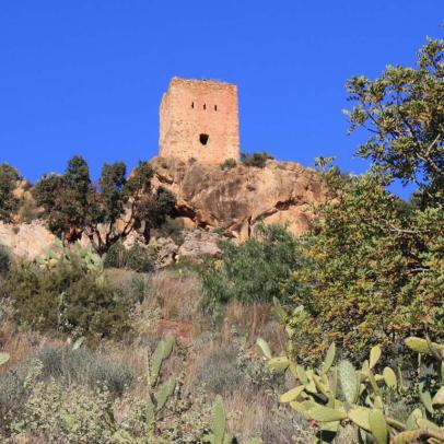
The castle is placed on a hill, at 175 metres height above sea level. Although the hiking trail is not well marked throughout, it is stroller-friendly, involving an easy 2-km walk.
This castle, which belongs to the Greco-Roman period, is a large-scale defense complex built on an irregular base. It is 120 metres long and 20-25 metres wide and it consists of the main castle (which is placed at the highest part of the hill) and two towers.
According to El Cantar de Mío Cid, El Cid took the castle after the battle of Tévar. It needs to be noted that El Cantar stays close to history in this case: early in 1098, El Cid, who had already taken control of Valencia, began the siege of Almenara, where the Almoravid governor of Játiva had retired. After a siege of three months, the Almoravid troops surrended and El Cid took Almenara.
The fortress was originally made of three main parts: the castle, which is currently in very poor condition, was placed in the highest part of the hill; before the castle entrance was the albacara, including the old Mosque and reservoir, whose trace is still visible; the towers, which locals refer to as L'Agüelet and L'Agüeleta (granpa and granma), are situated on the east and west sides of the hills, flanking the main structure. They are well preserved, though the latter was restored in the 19th century to set up an optical telegraph.
The military importance of the castle was due to its position, situated halfway along the plains and the coast of Castellón and Valencia and on the way of the natural path leading to Aragón. It is highly recommended to climb to the castle. The path is steep but easy. Moreover, you will be able to enjoy the views and, most importantly, to understand why it was such a strategic position in the past.
Rev. PAB 26.12.18


